


上一期風河的謎團,在這一期中能否得到解決?聽聽下文吧。還有我們也許說不定會深入懷俄明州的盆地,看看里面有什么東西等待著我們。
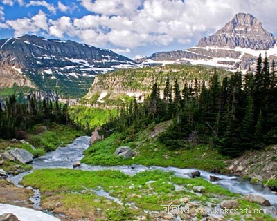
... in the west. When they came to the area around the Owl Creek Mountains, they assumed there were two rivers. North of the mountain flowed a river which they named Bighorn, thinking it was different to Wind River in the south. But later survey showed that the Bighorn and Wind River are in fact one river that channeled through the mountain.
Recently, geologists have come up with a possible answer, an answer that could also explain what happened to the once towering peaks of the Rockies. They proposed that millions of tons of rock eroded away, filled in the valleys and covered the lower parts of the mountains. It completely changed the terrain.
"At one point in ancient history, the basins in Wyoming were filled with sediments that had eroded off the mountains. This allowed the river to be at a higher plain and meander wherever it wanted to be on its course."
As the water flowed, it carved deep into the sediments and rock underneath.
"Eventually it cut down a channel into the mountain and eventually excavated right through the mountain."
But this is just a theory. Now geologists needed to find proof on the ground. The search is on for the rock that eroded from the early Rockies. The investigation moves to a series of thousand-foot-tall hills in the Powder River Basin in Wyoming. Known as the Pumpkin Buttes, they stand tall in an otherwise wide, empty landscape. Hidden behind the horizon are the Bighorn Mountains - the nearest range of the Rockies. These hills are not formed from solid rock, but a collection of rubble.
"This rock, we find all over the top of Pumpkin Buttes in Wyoming, is a granite, the closest granite we find to the series of the Bighorn Mountains nearly 100 miles to the West."
小編有約:在一次又一次的猜想和論證下,咱們和記者一起發現謎團,然后解開謎團。我想說當福爾摩斯的感覺還真不差。但似乎本期的問題記者并沒有解答論證出來,所以Daisy很期待這個答案。你呢?
課后題目:這次Daisy要考察考察大家的地理知識,請問在本期文章中出現了Wyoming的哪些地名?聽一聽找一找吧。


